Bing Maps Streetside, which provides an “on the ground” look at mapping locations, allowing you to “walk” certain streets and see stitched together photographic images of the area, has only up until this point been available for certain parts of certain cities in the US.
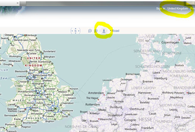
Now however, thanks to a tip from Alimaggs, it looks as though Bing Maps UK may be about to get some of the same functionality:
While no actual Streetside imagery is available for the UK at present, Bing Maps now sports the “little blue man” icon representing Streetside, and UK users can use it to view Streetside areas in US maps.
An FAQ on the Bing Streetside web page confirms that the UK is first on the list:
Q. When will street level imagery include international markets?
A. Microsoft has already collected imagery in 56 US metro areas as well as in selected areas in Canada. In April 2011, Microsoft will begin collecting street level imagery in Europe, starting in the UK with France, Germany and Spain following soon after.
And according to a report in The Telegraph, Navteq/Bing branded cars (4 of them initially) are already mapping out London.
(thanks for the tip! Remember you can reach us at tips *at* liveside *dot* net with anything fun and interesting you find!)


